










Loon Lake Mountain

- Distance~5.9 miRound trip
- Summit~3,330 ftElevation
- Ascent~1,700 ftTotal gain
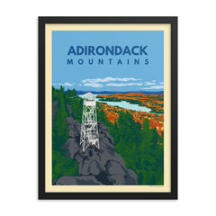
Loon Lake Mountain is part of the fire tower challenge, and what can be seen from the peak's rock face is beautiful and serene. Like most of the other fire tower peaks, it looks out mostly over nearby lakes, with Loon Lake the closest and the High Peaks off in the distance to the east.
The trail
The trail begins on a wide, unused forest road and follows it gradually through a deciduous forest for a couple of miles. With about one mile left, the trail becomes steeper and narrower as it enters conifer forest. Continue up through these woods for the final and steepest section to the top. The trail as it stands opened to the public in 2013.
The fire tower
- Difficulty
- Moderate
- Fire tower
- Closed to the public
- The trail
- Old forest road to start, then steeper through conifer forest for the last mile
- Land unit
- Debar Mountain Wild Forest
Trailhead and map
From Saranac Lake, drive through Bloomingdale on Route 3 and turn left on Route 26 toward Loon Lake. From the town of Loon Lake, follow Route 26 for 4.8 miles. The trailhead and parking lot are marked by a sign on your left.
Trail resources
- Conditions
- Conditions change fast. Check current trail conditions before heading out.
- Reading
- Hiking Fire Lookouts: New York, a guide to 85 fire tower hikes across the state. Affiliate link: as an Amazon Associate, Pure Adirondacks earns from qualifying purchases.
From the PureADK shop


