

#12 Giant Mountain
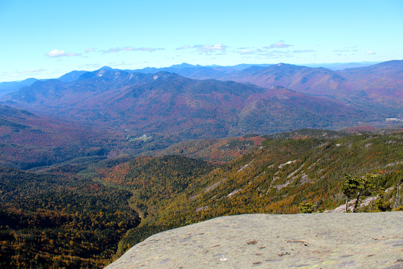
Giant Mountain is one of the more accessible and straight-forward high peaks. There is a great view from the top, and afterward, you can cross the road and go for a swim in Chapel Pond. For another post-hike cooldown, you could grab an ice cream at the Noonmark Diner if you’re driving back through Keene Valley.
#DackFact – Giant was the first of the 46 Adirondack High Peaks to be summited – it was summited in 1797 and named “Giant of the Valley” because its face loomed large over Saint Huberts.
Trail Stats:
| Distance | 6 miles round-trip |
| Elevation | 4,627 feet |
| Ascent | 3,050 feet from Rte 73 |
We will describe the route up Giant via the Ridge Trail here because it is the shortest and most popular route to the top. The original trail is the Roaring Brook trail, and that one is 7.2 miles round trip. Another option if you’re feeling ambitious is hiking both Giant and Rocky Peak Ridge via the Rocky Peak Ridge Trail, detailed here. If you can caravan cars, you can make the trip a loop – beginning at either the Ridge or Roaring Brook trailhead and ending at the other.
Begin hiking at the trailhead on Route 73. You will cross a small brook before arriving at the trail register. Sign in, and continue up the trail as it begins to climb, crisscrossing a stream as it continues upward for 0.3 miles. At 0.5 miles the trail will level out a bit, climbing again soon to 0.7 miles, at which point you will reach a viewpoint overlooking Chapel Pond. The trail will then quickly take you to Giant’s Washbowl, a pleasing pond that has good skating in the winter, and around the washbowl to the right. The trail to the left will take you to the lower section of the Roaring Brook trail. After you have followed the trail around the Washbowl to the right, the trail will continue along until it reaches the summit of Giant’s Nubble at 1 mile. If any members of the party want a shorter hike with less vertical, they can take a left off to the summit of Nubble and loop back around to the Washbowl, passing Roaring Brook Falls on the way for a grand total of 4.7 miles.
For those who choose to continue onwards to Giant, bear right at this vista on the top of Nubble and continue on for 0.2 miles. At this point, the climbing steepens. At 0.3 miles there is a nice stopping point with views of both the Washbowl and Chapel Pond. There will be two cairns – take a left here and follow the trail as it rolls across further bare ledges. At approximately 1.5 miles the trail will open up and follow somewhat steeply along open rock until you reach a junction at 1.7 miles. Both trails lead to the top – the trail to the right has slightly more viewpoints along the way and is 100 yards longer. If you take the trail to the left, you will climb gradually across the rock until you reach the intersection with the Roaring Brook Trail at 2.2 miles. Turn right onto the Roaring Brook Trail and hike a short ways at moderate steepness where you will have a great view of the slides on Giant at 2.3 miles. For the next 0.7 miles, the trail will alternate between steeper and more moderate pitches until you reach the summit at 3.0 miles.
Trailhead:
📍Google Maps // The trailhead starts along route 73 – if you are coming from the intersection of 9 and 73, follow 73 north 4.1 miles and you will see the parking area on your right. If this pullover is full, you can continue 0.2 miles up the road to additional parking on the other side of the road by Chapel Pond.